Chesapeake Bay Climate Adaptation Toolbox
AdaptVA: Tidewatch Map
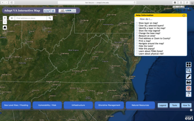
Developed By: Virginia Institue of Marine Science (VIMS) Center for Coastal Resources Management (CCRM)
Summary: The AdaptVA Tidewatch Map uses an interactive map to display coastal flooding in Virginia.
This easy-to-use tool provides 36-hour forecasts of coastal flooding, which are updated daily at 6:00 am and 6:00 pm. Users may click through or automate the display to view hourly forecasts over the next 36 hours. The tool contains location-specific plots of water level over time.
Get This Tool: https://cmap2.vims.edu/SCHISM/TidewatchViewer.html
Geographic Coverage
- Coastal Virginia
Tags
- Real-time/Current
- Forecast
- Regional level
- Computer application
- Interactive interface/map
- Subdaily
Cost
- Free
Skill Level
- Low