Chesapeake Bay Climate Adaptation Toolbox
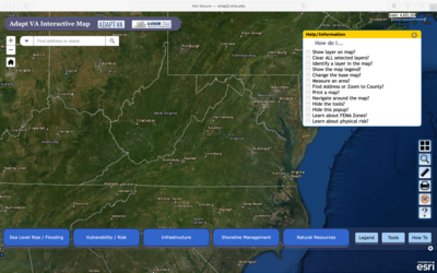
AdaptVA: Interactive Map
Developed By: Virginia Institue of Marine Science (VIMS) Center for Coastal Resources Management (CCRM)
Summary: This tool from AdaptVA uses an interactive map to display sea level rise projections and FEMA flood hazard zones, as well as social vulnerability, infrastructure, and natural capital in a single viewer.
This easy-to-use tool provides three sea level rise scenarios (low, intermediate, and extreme), which can be viewed at 10-year increments from 1992 – 2100. Users may click through or automate the display to view 10-year intervals for each sea level rise scenario. Users can also overlay addition features portraying vulnerability/risk, infrastructure, recommended shoreline management, and natural resources. This tool is intended for beginner users and does not require any specialized software or training.
Get This Tool: http://cmap2.vims.edu/AdaptVA/adaptVA_viewer.html
Geographic Coverage
- Virginia
Tags
- Historical
- Real-time/Current
- Climate projections
- Jursidiction based
- Grid based
- Location specific
- County level
- State level
- Computer application
- Interactive interface/map
- Compare scenarios/locations
- Solutions
- Downloadable results
Cost
- Free
Skill Level
- Low