Chesapeake Bay Climate Adaptation Toolbox
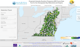
MARISA Data Tools: Projected Intensity-Duration-Frequency (IDF) Curve Data Tool for the Chesapeake Bay Watershed and Virginia
Developed By: Mid-Atlantic Regional Integrated Sciences and Assessments (MARISA) program
Summary: MARISA’s Projected Intensity-Duration-Frequency (IDF) Curve Data tool provides climate-change informed IDF curves for counties across the Chesapeake Bay Watershed and Virginia. Using the tool, IDF curves can be easily integrated and used to plan, design, and build infrastructure assets to be more resilient to climate change.
Get This Tool: https://midatlantic-idf.rcc-acis.org/
Geographic Coverage
- Delaware; Maryland; New York; Pennsylvania; Virginia
Tags
- Climate projections
- Location specific
- Computer application
- Interactive interface/map
- Compare scenarios/locations
- MARISA
Cost
- Free
Skill Level
- High