Chesapeake Bay Climate Adaptation Toolbox
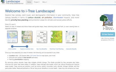
i-Tree: Landscape
Developed By: United States Department of Agriculture (USDA) Forest Service, Davey Tree Expert Company, The Arbor Day Foundation, Society of Municipal Arborists, International Society of Arboriculture, Casey Trees, and SUNY College of Environmental Science and Forestry
Summary: i-Tree Landscape provides the broader context of tree benefits through an interactive map displaying tree canopy, land cover, and basic demographic information. This tool also generates a report summarizing local land use, demographics, and tree cover/benefits for a specific location.
i-Tree Landscape is intended to reach a wide audience of individuals who may not be subject matter experts. This includes the public, landowners, real estate agents, educators, and Community Officials. Because of its easy-to-use interface this tool reaches a wider audience than more complex i-Tree tools. i-Tree landscape also has the option to view RCP 4.5 and RCP 8.5 and multiple health risk scenarios. In creating the report users have the option to give factors low and high priority and weight factors separately.
Get This Tool: https://landscape.itreetools.org/
Geographic Coverage
- Contiguous United States
Tags
- Real-time/Current
- Climate projections
- Jursidiction based
- Location specific
- Computer application
- Interactive interface/map
- Cost estimates
- Downloadable results
Cost
- Free
Skill Level
- Medium